Discussion
Loading...

Post

  • About
  • Code of conduct
  • Privacy
  • About Bonfire
Mapas Milhaud
@mapasmilhaud@mapstodon.space  ·  activity timestamp 2 days ago

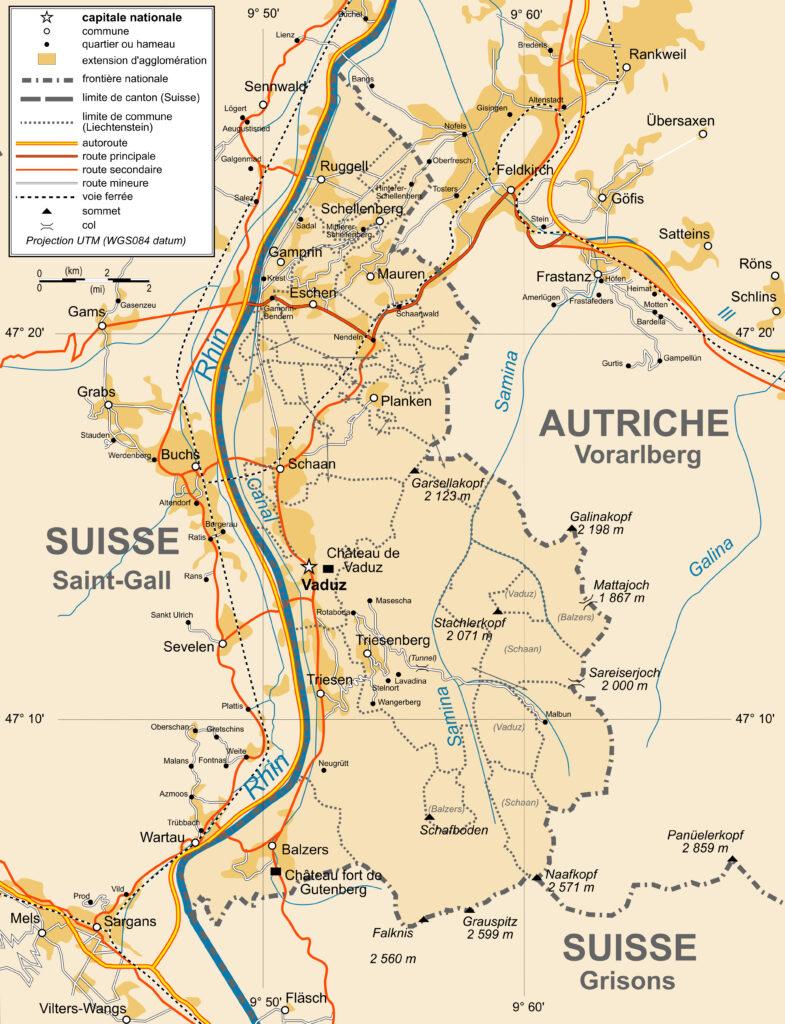
Mapa político de Liechtenstein (2009) https://mapasmilhaud.com/mapas-politicos/mapa-politico-de-liechtenstein-2009/

#Maps #Mapas

Mapas Milhaud - Una colección de mapas

Mapa político de Liechtenstein (2009)

Este mapa, creado por Bourrichon para Wikimedia Commons en 2009, muestra Liechtenstein. Con una línea punteada, se muestran los once municipios en los que se divide el país. Además, en rojo se muestran las carreteras y en azul los ríos, entre los que destaca el Rin, el cual define la frontera entre Liechtenstein y Suiza. Fuentes Liechtenstein
Mapa político de Liechtenstein (2009)
  • Copy link
  • Flag this post
  • Block
Log in

BT Free Social

BT Free is a non-profit organization founded by @ozoned@btfree.social . It's goal is for digital privacy rights, advocacy and consulting. This goal will be attained by hosting open platforms to allow others to seamlessly join the Fediverse on moderated instances or by helping others join the Fediverse.

BT Free Social: About · Code of conduct · Privacy ·
Bonfire community · 1.0.0 no JS en
Automatic federation enabled
  • Explore
  • About
  • Public Groups
  • Code of Conduct
Home
Login