
Our weather station hit 91F today (4th of February). Studio is currently 84F at sunset. All is well at the apocalypse.

FinchHaven sfba
boosted


FinchHaven sfba
boosted
Look at that tule fog in California's central valley....
(Terra/MODIS via NASA Worldview)

Look at that tule fog in California's central valley....
(Terra/MODIS via NASA Worldview)
Look at that tule fog in California's central valley....
(Terra/MODIS via NASA Worldview)
deewani
boosted
#CAwx
The Climate Prediction Center highlights above normal precipitation late weekend into early next week.

#CAwx
The Climate Prediction Center highlights above normal precipitation late weekend into early next week.
")
#SnowMoon with temps in the 80s, nearly 20F above average #ClimateDiary #CAwx
FinchHaven sfba
boosted
#CAwx #MTR #graphicast
A Beach Hazards Statement is in effect through 9 AM Monday for Pacific Coast beaches. Remember: stay off of jetties, piers, rocks, and other waterside infrastructure, remain out of the water to avoid hazardous surf, and never turn your back on the ocean.
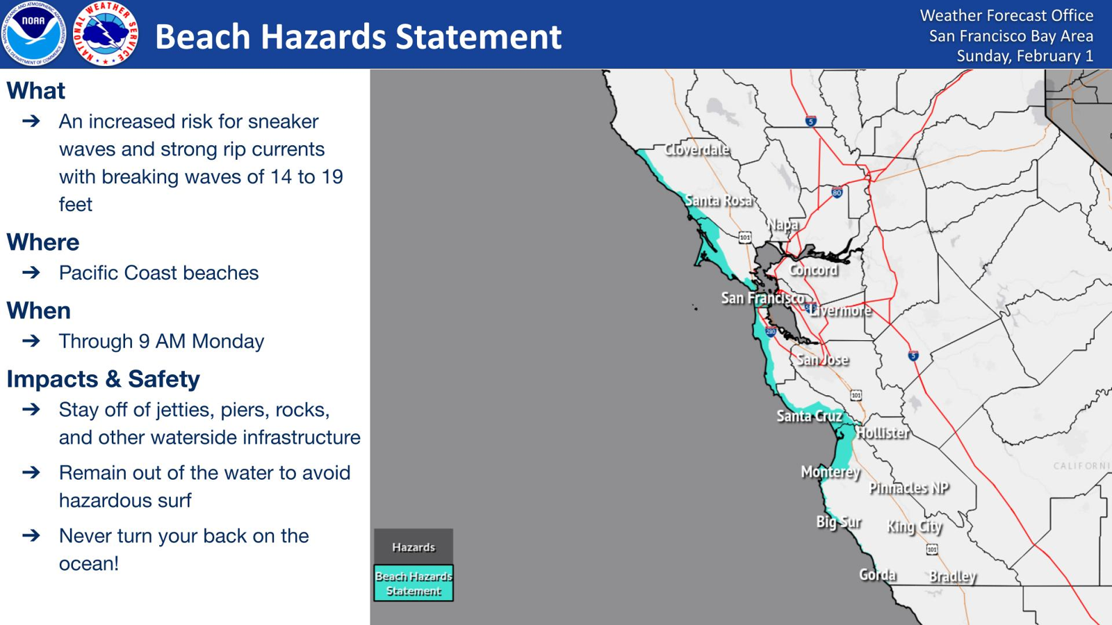
#CAwx #MTR #graphicast
A Beach Hazards Statement is in effect through 9 AM Monday for Pacific Coast beaches. Remember: stay off of jetties, piers, rocks, and other waterside infrastructure, remain out of the water to avoid hazardous surf, and never turn your back on the ocean.
FinchHaven sfba
and 1 other
boosted
ABC News: Dense fog causes pileup on California highway involving at least 50 cars
Highway 99 is closed in both directions in central California.
ByJulia Jacobo
January 31, 2026, 1:55 PM
https://abcnews.go.com/US/dense-fog-causes-pileup-california-highway-involving-50/story?id=129739459
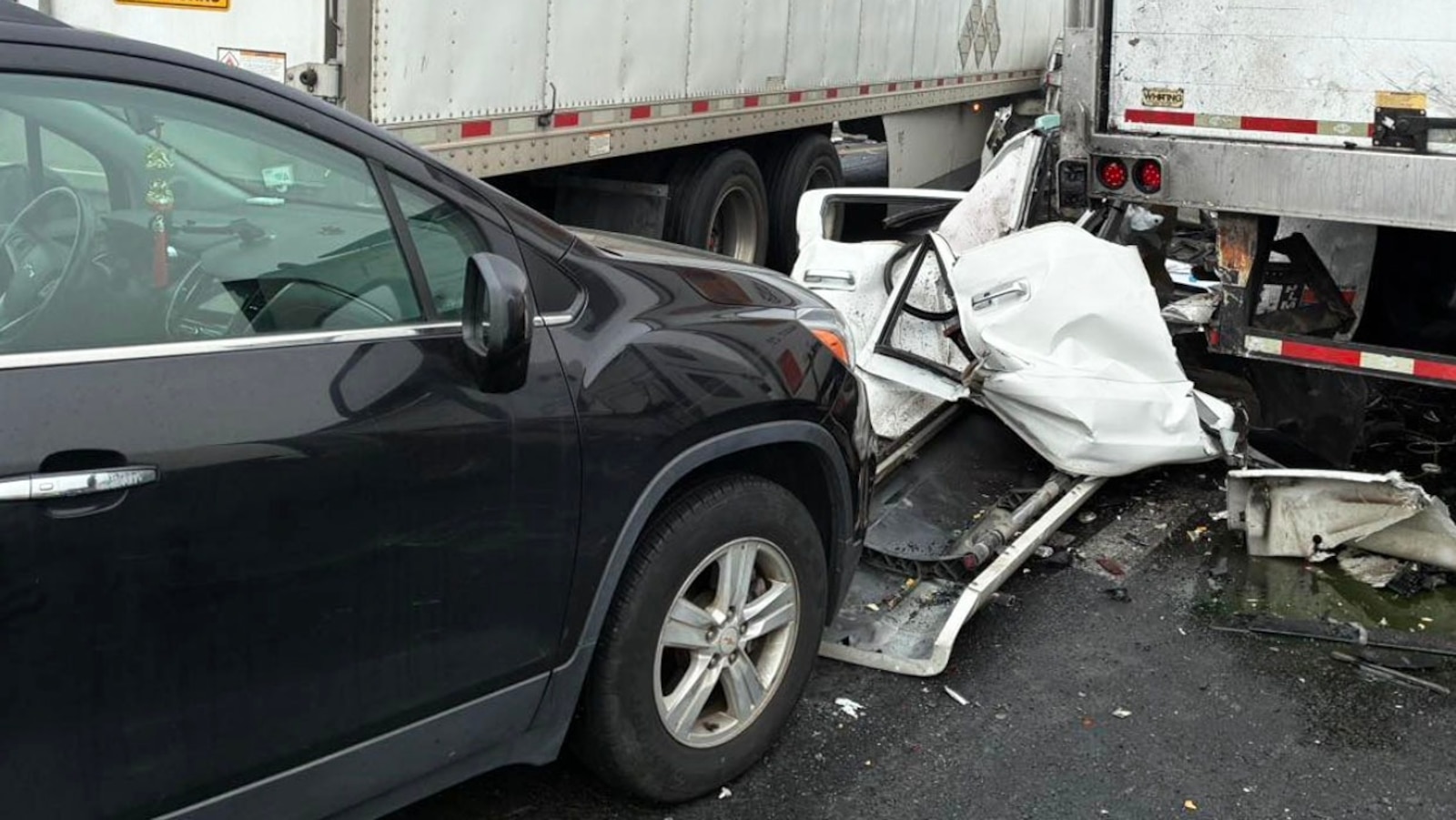
ABC News: Dense fog causes pileup on California highway involving at least 50 cars
Highway 99 is closed in both directions in central California.
ByJulia Jacobo
January 31, 2026, 1:55 PM
https://abcnews.go.com/US/dense-fog-causes-pileup-california-highway-involving-50/story?id=129739459
deewani
boosted
#CAwx #MTR #graphicast
A Coastal Flood Advisory is in effect through 12 PM Sunday for bayshore locations along the San Francisco Bay, San Pablo Bay, and Monterey Bay. Minor coastal flooding is expected during the highest tide of the day.
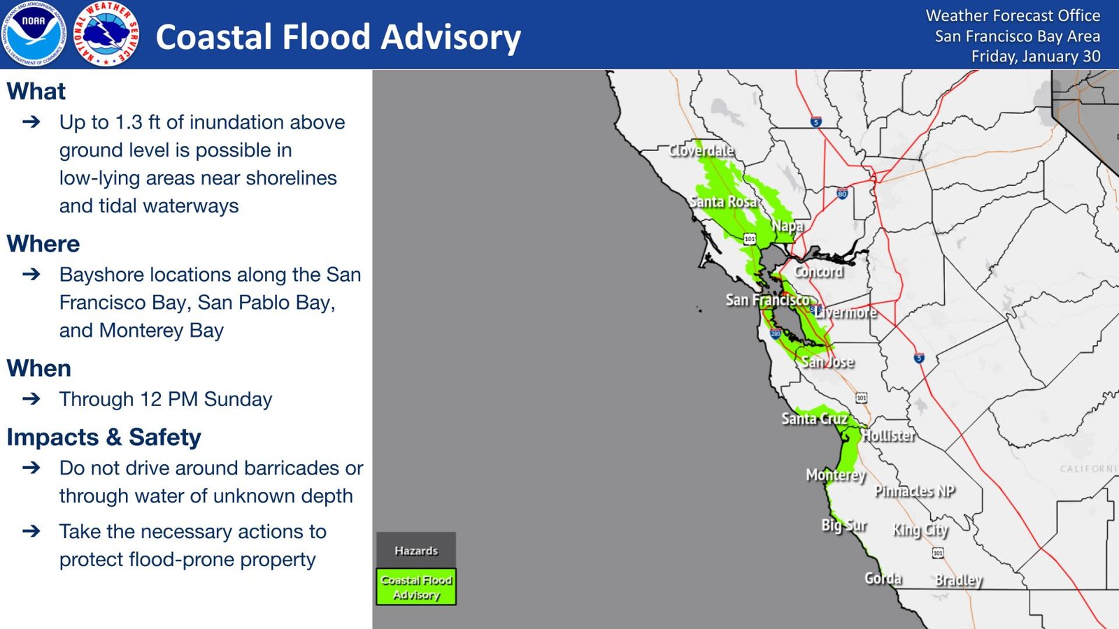
#CAwx #MTR #graphicast
A Coastal Flood Advisory is in effect through 12 PM Sunday for bayshore locations along the San Francisco Bay, San Pablo Bay, and Monterey Bay. Minor coastal flooding is expected during the highest tide of the day.