Rob 🏳️🌈 Rartsy Humanist
boosted
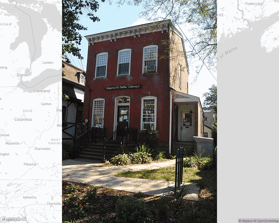
Hopewell Public Library, public library in Hopewell, New Jersey.
Hopewell Public Library, public library in Hopewell, New Jersey.
Hopewell Public Library, public library in Hopewell, New Jersey.
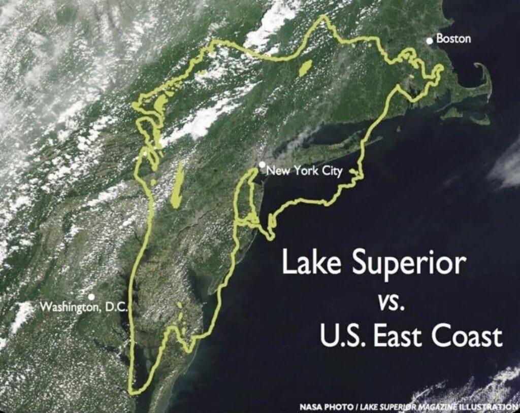
Lake Superior compared to east coast of United States https://www.byteseu.com/1785270/ #Map #MapPorn #MapPorn #Maps
Lake Superior compared to east coast of United States https://www.byteseu.com/1785270/ #Map #MapPorn #MapPorn #Maps
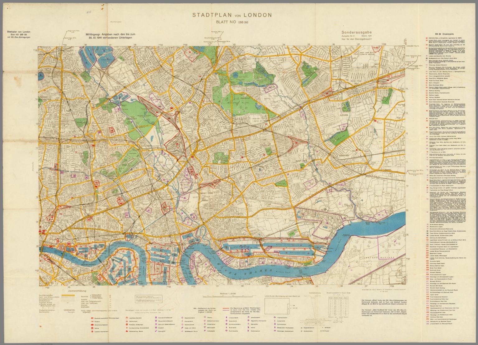
Stadplan von London, Blatt NO (BB 29). (Map of London, Northeast Sheet (BB 29)). Sonderausgabe, Ausgabe Nr. 2. Stand: 1941. (Special Edition, Issue No. 2. Date: 1941). Nur fur den Dienstgebrauch! (Only for internal use only!). Militargeogr. Angaben nach den bis zum 30. XI. 1941 vorhandenen Unterlagen. (Militargeogr. Information as of November 30,1941 Existing documents). Generalstab des Heeres. Abtteilung fur Kriegskarten und Vermessungswesen (IV. Mil. Geo.) (General Staff of the Army. Department for War Maps and Surveying (IV. Mil. Geo.)). Published in 1940. https://www.davidrumsey.com/luna/servlet/detail/RUMSEY~8~1~275461~90055202
Stadplan von London, Blatt NO (BB 29). (Map of London, Northeast Sheet (BB 29)). Sonderausgabe, Ausgabe Nr. 2. Stand: 1941. (Special Edition, Issue No. 2. Date: 1941). Nur fur den Dienstgebrauch! (Only for internal use only!). Militargeogr. Angaben nach den bis zum 30. XI. 1941 vorhandenen Unterlagen. (Militargeogr. Information as of November 30,1941 Existing documents). Generalstab des Heeres. Abtteilung fur Kriegskarten und Vermessungswesen (IV. Mil. Geo.) (General Staff of the Army. Department for War Maps and Surveying (IV. Mil. Geo.)). Published in 1940. https://www.davidrumsey.com/luna/servlet/detail/RUMSEY~8~1~275461~90055202
Scientists create the most detailed groundwater map yet — with big implications for the West
Researchers at Princeton University, in collaboration with the University of Arizona, have produced the most detailed map yet of groundwater depth across the continental United States. The map estimates how deep groundwater sits beneath the surface with greater accuracy, with detail down to areas about 100 feet across.